Leveraging GIS for Renewable Energy Projects in Australia
Australia is advancing a renewable energy revolution, leveraging its abundant solar, wind, and water resources with the support of cutting-edge Geographic Information Systems (GIS) technology. GIS technology enables precise planning, data analysis, and visualisation, making it essential for the growth of renewable energy in Australia. With exceptional solar radiation, strong coastal winds, and vast landscapes, the nation has unmatched potential for solar energy, wind energy, and hydroelectric projects. However, to capitalize on these resources, developers require sophisticated spatial analysis tools like GIS technology to manage environmental, regulatory, and infrastructure complexities.
Renewable energy in Australia has surged, accounting for over 35% of national electricity generation. By 2030, this is expected to reach 50%. GIS technology supports this growth by enabling accurate site selection, resource assessment, and streamlined permitting, while ensuring environmental protection and cost efficiency. Integrating meteorological data, land surveys, and infrastructure information, GIS platforms guide informed decisions throughout every phase of solar, wind, and hydroelectric project development in Australia.
Solar Energy Planning and GIS Optimization
Australia’s solar energy sector is thriving, largely due to the application of GIS technology for project planning and management. GIS technology empowers stakeholders to conduct advanced solar resource assessments, identify suitable land, and optimize photovoltaic panel placement for maximum solar energy output.
Solar Resource Assessment and Site Suitability Analysis
A vital role of GIS technology in solar energy planning is comprehensive resource assessment. By combining satellite solar radiation data, weather patterns, and atmospheric models, GIS systems produce high-resolution maps highlighting Australia’s prime solar energy locations. These analyses consider variables like cloud cover and seasonal sunlight fluctuations, delivering accurate projections for solar energy potential.
Site suitability analysis using GIS technology evaluates factors such as land ownership, terrain, transmission line proximity, and environmental impact. This allows project developers to select optimal land, avoid costly slopes or shaded areas, and minimize conflicts with agricultural or residential land. Leading organizations, such as the Australian Photovoltaic Institute, rely on GIS platforms to access real-time solar resource databases during the project planning process.

Click image to read the full article on renewable energy trends.
Grid Integration and Transmission Planning
GIS technology streamlines grid integration by mapping connectivity options to the national electricity grid. Careful analysis of existing infrastructure, environmental constraints, and topography enables efficient transmission line planning. This not only reduces project costs for solar energy developers but also accelerates the delivery of clean electricity to Australian communities.
Wind Energy Projects in Australia: The Role of GIS Technology
The ongoing expansion of wind energy in Australia is heavily supported by the analytical capabilities of GIS technology. From onshore to offshore wind energy projects, GIS supports every phase—resource mapping, turbine placement, risk assessment, and environmental management.
Wind Resource Mapping and Turbine Layout Optimization
Wind resource mapping—powered by GIS technology—merges meteorological datasets with topographical features to identify locations with sustained, high wind speeds optimal for wind energy production. The Australian Wind Energy Atlas is a practical example, delivering high-resolution data crucial for identifying viable development sites.
Turbine placement and micrositing are optimized using GIS modeling. Analysis of wind flow, wake effects, terrain, and proximity to transmission infrastructure ensures maximum energy yield and minimal operational losses. GIS-facilitated turbine layouts can significantly enhance energy output and investment returns on wind energy projects in Australia.
Offshore Wind Energy and Marine GIS Analysis
Australia’s coastlines offer outstanding potential for offshore wind energy. GIS technology, equipped with bathymetric and marine spatial datasets, supports site selection and impact assessments by highlighting suitable water depths and minimizing environmental conflicts. Analysis includes marine shipping lanes, fishing zones, and sensitive habitats, ensuring offshore wind energy projects are deployed responsibly and with minimal ecological disruption.
Explore more about Wind Energy in Australia
Hydroelectric Projects in Australia Supported by GIS
Australia’s hydroelectric sector relies on GIS technology for rigorous hydrological modeling, infrastructure planning, and environmental stewardship. From traditional river-based power generation to innovative pumped hydro energy storage, GIS is vital for evaluating water resource availability and site suitability.
Hydrological and Environmental Analysis in GIS
Hydrological models in GIS assess water flow, seasonal patterns, and site viability for hydroelectric energy projects. For example, the Australian National University’s Pumped Hydro Atlas employs GIS to shortlist thousands of feasible storage sites, supporting grid reliability during periods of peak energy demand.
GIS also delivers environmental insights—analyzing aquatic habitats, fish migration pathways, and water quality impacts. Developers use these insights to minimize ecosystem disruption and design compliance strategies that meet Australia’s stringent environmental standards.
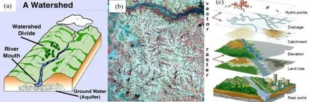
Click image to read the full article on hydrology modelling.
Benefits of GIS Technology for Renewable Energy Project Success
Advanced Site Selection and Resource Optimization
GIS technology enables in-depth, multi-criteria analysis for effective site selection. By integrating solar, wind, and hydro resource data with topography, land use, and infrastructure maps, GIS reveals the most promising locations for renewable energy in Australia while highlighting development barriers and risks.
Risk Management and Resilience with GIS
GIS is essential for climate and natural hazard risk assessments. Through spatial modelling, developers identify flood-prone zones, bushfire risks, or cyclone paths and design projects with resilience in mind. GIS models grid stability and infrastructure vulnerability, ensuring sustainable operation of solar energy, wind energy, and hydroelectric projects in Australia’s challenging environments.
Environmental Compliance and Cumulative Impact Assessment
Balancing energy development and environmental protection is made possible with GIS-driven habitat mapping, species distribution modeling, and landscape connectivity analysis. Furthermore, GIS supports the coordination and management of cumulative impacts from multiple projects within a single region, safeguarding biodiversity and community interests.
The Future of GIS Technology in Australia’s Renewable Energy Sector
Emerging technologies are transforming GIS applications in renewable energy in Australia. The integration of artificial intelligence (AI) enables automated site identification, predictive generation modeling, and smarter operations management. Digital twin platforms—virtual versions of renewable projects created from GIS and real-time data—improve scenario planning and stakeholder engagement. Blockchain integration promises transparent, tamper-proof records for renewable energy certificates and carbon credits, enhancing compliance and market trust.
Conclusion: GIS Technology Powers the Future of Renewable Energy in Australia
GIS technology is foundational for scaling renewable energy in Australia—optimizing site selection, resource allocation, and environmental compliance for solar energy, wind energy, and hydroelectric projects. Modern GIS systems empower energy stakeholders to make informed, data-driven decisions, contributing to Australia’s clean energy goals, economic growth, and environmental sustainability.
The strategic application of GIS technology will continue to drive innovation and leadership in Australia’s renewable energy sector, illustrating the value of spatial analysis in building a secure, sustainable energy future.
For more insights on GIS technology in renewable energy projects, contact our team or explore our latest articles on sustainable energy solutions in Australia.